projects
Inner Block House
The apartment on the canal
Office Building
Urban village in Tokyo
Housing TransformationsFamily Loft
Secret Garden
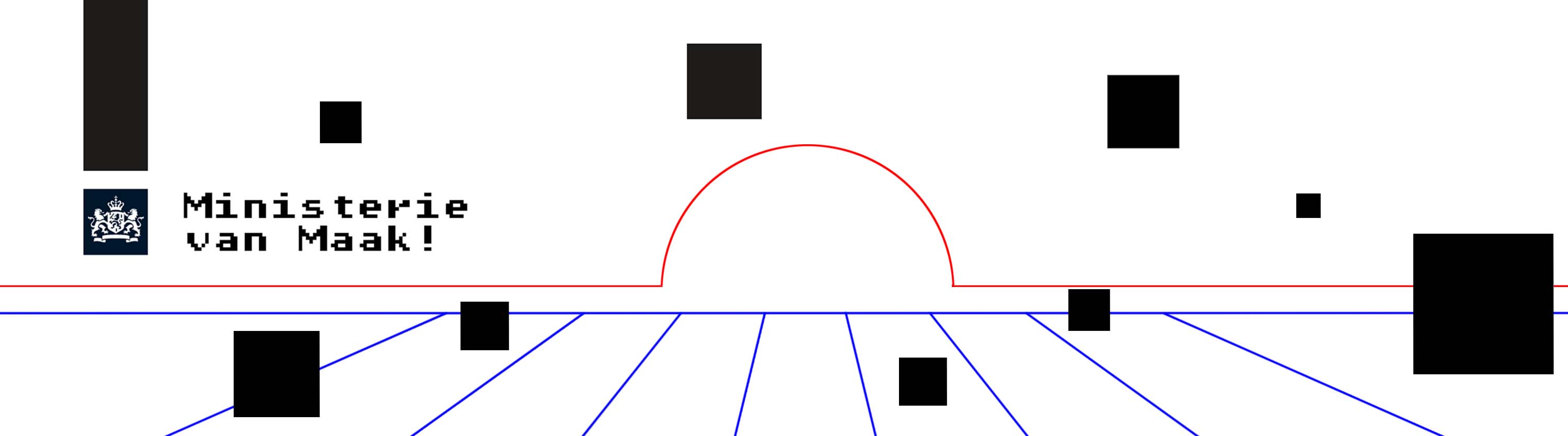
Ministerie van Maak
Transform&extend
Micro-House
The hotel
Villa Veenmmol
Villa Minerva
Watchtower Zaanse
Story from the woods
Book art fair
School yard Rotterdam
competitions
Tili Wine Italy Guest home
Europan 16
Sminchov City
Ethiopian Satellite Preschool
Castel resort. Italy
Smart Harbor. Italy
Space of Culture.
Children park. Kazan
Social housing Westerlo
Extension A.Alto museum 1
Extension A.Alto museum2
Two museums. Budapest
Social housing. Greece
“up to 35”. Greece
about us / contact
projects
Secrer Garden
Family Loft
Ministerie van Maak
Transform&extend
Micro-House
The hotel
Tiny house Rotterdam
Vila Veenmmol
Watchtower Zaanse
Story from the woods
Book art fair
Family house in Weesp
School yard Rotterdam
competitions
Sminchov City
Castel resort
Smart Harbor
Space of Culture
Children park Kazan
Social housing Westerlo
Extention A.Alto musium 1
Extention A.Alto musium2
Two museums ,Budapest
Social housing,Greece
about us
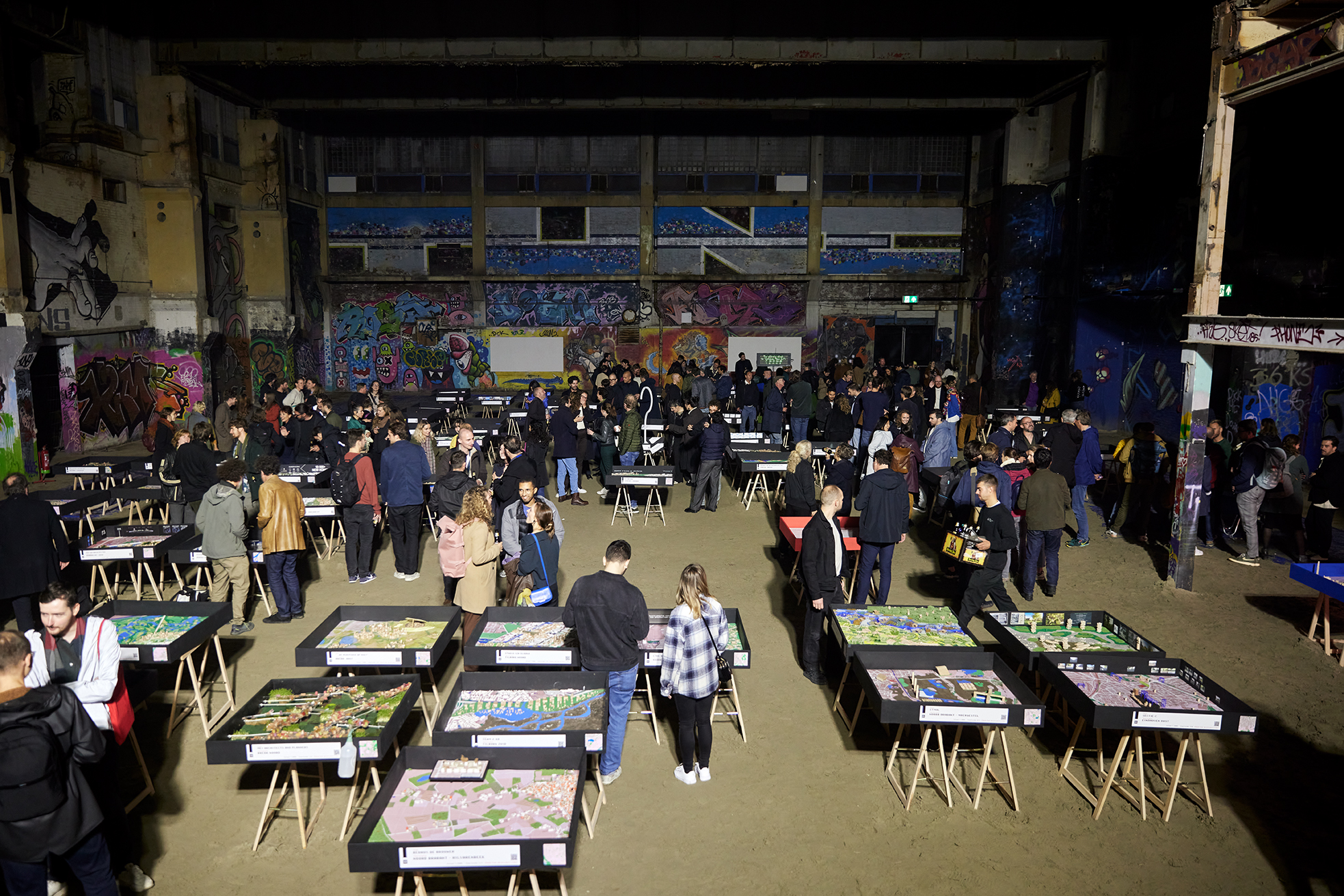
Interdantional Architecture Bienale Rotterdam
Publication , Publication
Team IRIX: Irini Xanthopoulou,Iraklis Romanopoulos,Yannis Tsoskounoglou,Dimitris Rigas
The Mission
“The new inter-ministerial Ministry of Make calls on a hundred designers and experts to use their collective knowledge and imagination to come up with new designs for the Netherlands. With this, the Ministry of Create wants to contribute to the radical renovation of the Netherlands and offer concrete solutions for the housing shortage, the energy transition and the consequences of climate change. Moreover, the Ministry of Make encourages reflection on the way in which the existing government structures deal with this.
"As a community, we are faced with a number of major transformations; these tasks all have a spatial impact. The Netherlands not only has a tradition of coping with such complex tasks, but also a contemporary architectural discipline and the design power to make an inspiring contribution to the urgencies of today." , say the initiators of the International Architecture Biennale Rotterdam (IABR), MANN and ZUS, together with VOLUME and the Independent School for the City.
1 million extra climate-proof homes
The Ministry's main objective is to bring together solutions for various social challenges in a spatial approach, such as the consequences of climate change, subsidence, sea level rise, the nitrogen problem and the energy transition. In concrete terms, the Ministry wants to work responsibly on the housing task of 1 million additional climate-proof homes. It is also important to find solutions for conflicting regulations and the need for alternative forms of cohabitation and financing.
National plan map completed with local design power
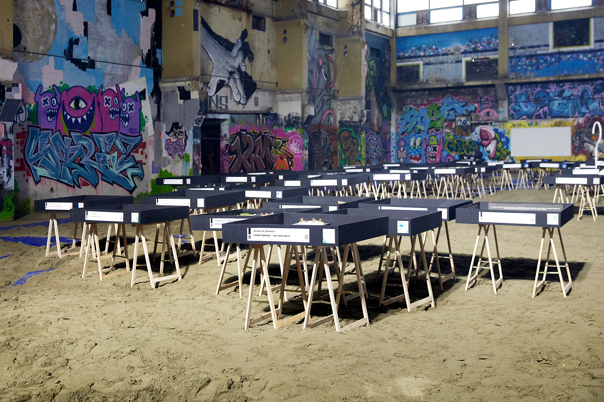
The ministry has issued a concrete assignment for 100 designers with the request to conduct research into the development of 10,000 climate-proof homes within their area and to make a design for this. The designers and specialists receive a Test Kit containing everything they need. They also consult with the team of any adjacent area. Each design team makes concrete proposals to create a spatial whole of the Netherlands. With the initiative, the Ministry of MAAK is applying an approach that is national, but also local, based on the specific situation of 100 concrete 'Test Locations'. It is a national planning map as it also existed before, but now filled in with local design power.“
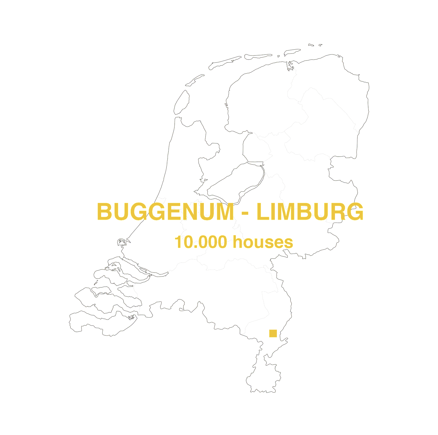
10.000 homes x 100 locations = 100 Architectural offices accross Netherlands
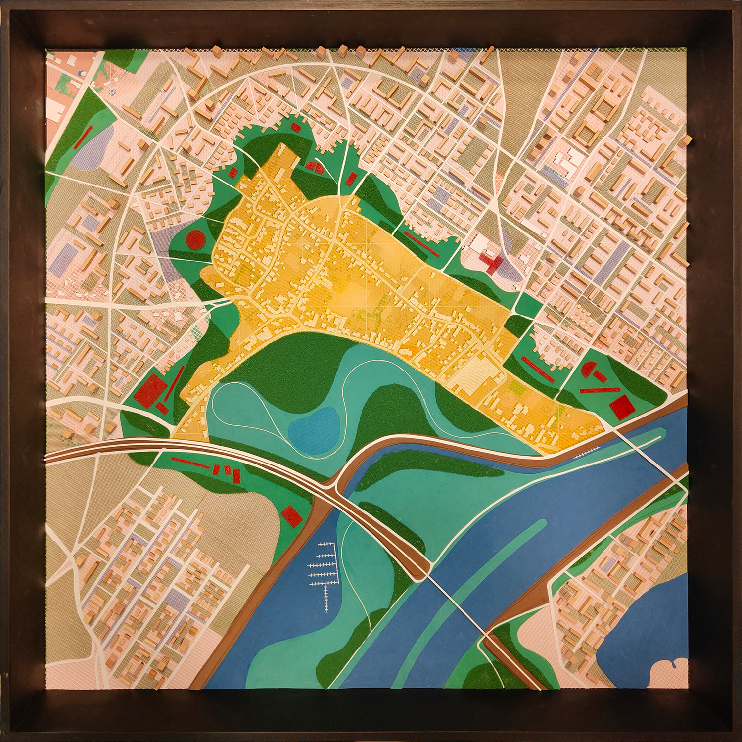
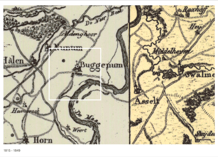
Location - BUGGENUM, LIMBURG
Buggenum is a parish village in the Dutch province of Limburg. The village lies on the left bank of the river Maas, as the crow flies about five kilometres north of Roermond and has around a thousand inhabitants. Before 2007, it belonged to the former municipality of Haelen, but is now part of the municipality of Leudal. Buggenum was an independent municipality until 1942. From a landscape perspective Buggenum lies along the Maas, at an altitude of about 20 metres. Water canals are connecting the town to its former power plants, as well as a harbour. Until 1947, Buggenum was connected via a ferry Roermond. The course of the Maas was radically altered by cutting off riverbanks and by gravel extraction, creating a series of extensive ponds and small water bodies. To the northeast of Buggenum one finds the Bouxweerd nature reserve. The Buggenumse Veld to the west of this is a preserved open agricultural area.
Intro
Our first impression right at the beginning is that it is an area of extremely landscape importance. Landscape played an important role in our decision-making process. A first challenge came in a form of a research question directly out of the brief on “How to fit 10k extra housing units?” However, coupled this with the fact that Buggenum is surrounded by areas ecological value limited our scope of intervention substantially.
Strategy/Objective
As a result, we defined 4 guiding principles /goals that we tried to maintain throughout the design process:
- Preserve as much as possible the landscape and its qualities (Bouxweerd and Buggenumse Veld)
- Protect housing and new developments from water rise (water safety strategy)
- Utilize existing infrastructure and provide ample accessibility option for the inhabitants.
- Strengthen the role of Buggenum in the area.
Actions
Action 1: Define the areas that won’t be considered for future development. That were Buggenummerbroek a currently natural area with the potential in the future to facilitate recreation activities (bike running etc). At the same time given the nature of the west part and its use as former industrial site we decide not to intervene but to restore it in a ecological original status.
Action 2: Reroute and reinforce the existing dike. We had look at the city plans of the proposed dike but given the fact of densification we had to reassess the course so to expand the development area up until the banks of the river. Additionally, we prolonged it underneath the rail line creating a protective barrier allowing housing to be located.
Action 3: Create a green buffer around Buggenum to protect the original town from further densification but also establishing an essential interaction zone between new and old where most amenities and recreational facilities are taking place.
Action 4: Reprofiling and strengthening existing axis towards the north. The existing polderstructure and street network worked as a helpful underlay for us to define the future street pattern. At the same time, we saw an opportunity of a potential relationship with the nearby villages of Hannsum and Neer.
Action 5: Connect all the main streets thought a ring road that further continues to the south underneath the rail line. On the intersection of those two (ring and parallel streets) we find small centers that could accommodate all the retail and commercial requirements of the future inhabitants.
Action 6: Damping and careful land reclamation on specific areas. More specifically along the opposite riverbank we placed the remaining development so that on one hand to activate both sides of the river and secondly to create a steppingstone between Haelen on the (west) Buggenum and further to Roermond. At the same time reprofiling Holstraat (an existing and historic street that cuts though Buggenum) into a main artery connecting both riverbanks developments.
Conclusion
We can conclude that the additional 10.000 housing units proved more challenging than we initially thought. Nonetheless seeing this assignment more as a test/case study and less as a design competition we can safely say that within our given area a total of 6-7k housing could be an ideal amount to satisfy our main goals. Any more than that could pose a risk to the natural and ecological qualities of the area.